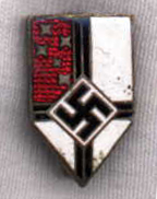
File:Flagge Reichskolonialbund2.svg

此 SVG 檔案的 PNG 預覽的大小:800 × 474 像素。 其他解析度:320 × 189 像素 | 640 × 379 像素 | 1,024 × 606 像素 | 1,280 × 758 像素 | 2,560 × 1,516 像素 | 1,346 × 797 像素。
原始檔案 (SVG 檔案,表面大小:1,346 × 797 像素,檔案大小:9 KB)
檔案歷史
點選日期/時間以檢視該時間的檔案版本。
| 日期/時間 | 縮圖 | 尺寸 | 使用者 | 備註 | |
|---|---|---|---|---|---|
| 目前 | 2021年7月28日 (三) 12:16 |  | 1,346 × 797(9 KB) | Fornax | Reverted to version as of 03:56, 15 February 2011 (UTC) : Nonsense |
| 2021年7月28日 (三) 10:35 |  | 512 × 303(2 KB) | Germenfer | The file is upside down. The flag was flown with the red canton in the lower mast section. It can be seen in this propaganda postcard from 1940: http://www.germanpostalhistory.com/php/viewitem.php?itemid=91130&germany%20cover=search&#littlepic0 | |
| 2011年2月15日 (二) 03:56 |  | 1,346 × 797(9 KB) | Fry1989 | fix | |
| 2008年11月3日 (一) 18:34 |  | 1,348 × 799(11 KB) | Fornax | Removing transparency | |
| 2008年11月3日 (一) 18:33 |  | 1,348 × 799(11 KB) | Fornax | {{Information |Description={{de|1=Flagge des Reichskolonialbunds 1933-1945}} |Source=Own work by uploader {{Inkscape}} |Author=Fornax |Date=2008 |Permission=see below |other_versions= }} <!--{{ImageUpload|full}}--> |
檔案用途
下列3個頁面有用到此檔案:
全域檔案使用狀況
以下其他 wiki 使用了這個檔案:
- de.wikipedia.org 的使用狀況
- en.wikipedia.org 的使用狀況
- es.wikipedia.org 的使用狀況
- he.wikipedia.org 的使用狀況
- אנטארקטיקה
- פטר הראשון (אי)
- ארץ המלכה מוד
- תבנית:אנטארקטיקה
- הטריטוריה הבריטית באנטארקטיקה
- שטח חסות רוס
- ארץ אדלי
- אנטארקטיקה הארגנטינאית
- הטריטוריה האנטארקטית האוסטרלית
- אנטארקטיקה צ'ילנה
- שוואביה החדשה
- ארץ ויקטוריה
- אנטארקטיקה הברזילאית
- בסיס חנרל ברנרדו אוהיגינס ריקלמה
- חוף סקוט
- חוף פאלייר
- רכס המלכה אלכסנדרה
- הר רוקר
- רכס ג'ונס הופקינס
- שלוחת אבוט
- הר האגינס (אנטארקטיקה)
- חוף פנל
- חוף רופרט
- חוף אוסקר השני
- חוף הובס
- חוף הנסיכה אסטריד
- חוף אינגריד כריסטנסן
- חוף הנסיך אולף
- חוף הנסיך האראלד
- חוף הנסיכה מרתה
- חוף לארס כריסטנסן
- חוף קמפ
- חוף אואטס
- חוף מוסון
- ארץ מרי בירד
- חוף אייטס
- ארץ המלכה אליזבת
檢視此檔案的更多全域使用狀況。


