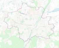
File:Karte der Stadtbezirke in München.png

預覽大小:719 × 600 像素。 其他解析度:288 × 240 像素 | 576 × 480 像素 | 921 × 768 像素 | 1,228 × 1,024 像素 | 2,002 × 1,670 像素。
原始檔案 (2,002 × 1,670 像素,檔案大小:1.47 MB,MIME 類型:image/png)
檔案歷史
點選日期/時間以檢視該時間的檔案版本。
| 日期/時間 | 縮圖 | 尺寸 | 用戶 | 備註 | |
|---|---|---|---|---|---|
| 目前 | 2012年8月14日 (二) 20:41 |  | 2,002 × 1,670(1.47 MB) | Chumwa | Grenzlinien überarbeitet |
| 2012年1月28日 (六) 09:46 |  | 2,001 × 1,669(1.41 MB) | Chumwa | Umlandgemeinden hinzugefügt | |
| 2012年1月26日 (四) 15:59 |  | 2,001 × 1,669(1.3 MB) | Chumwa | layout | |
| 2012年1月24日 (二) 05:46 |  | 2,001 × 1,669(1.25 MB) | Chumwa | {{Information |Description= *{{ de }} Karte der Stadtbezirke in München<br><br>''Hinweis'': Die dargestellten Grenzlinien können nur einen ungefähren Eindruck von deren tatsächlicher räumlichen Lage vermitteln. Für genauere Informationen deshalb bit |
檔案用途
下列頁面有用到此檔案:
全域檔案使用狀況
以下其他 wiki 使用了這個檔案:
- az.wikipedia.org 的使用狀況
- bg.wikipedia.org 的使用狀況
- ca.wikipedia.org 的使用狀況
- cs.wikipedia.org 的使用狀況
- de.wikipedia.org 的使用狀況
- eu.wikipedia.org 的使用狀況
- simple.wikipedia.org 的使用狀況
- sv.wikipedia.org 的使用狀況


