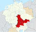
File:Austria locator map (1000).svg

此SVG文件的PNG预览的大小:619 × 599像素。 其他分辨率:248 × 240像素 | 496 × 480像素 | 793 × 768像素 | 1,058 × 1,024像素 | 2,116 × 2,048像素 | 1,875 × 1,815像素。
原始文件 (SVG文件,尺寸为1,875 × 1,815像素,文件大小:5.74 MB)
文件历史
点击某个日期/时间查看对应时刻的文件。
| 日期/时间 | 缩略图 | 大小 | 用户 | 备注 | |
|---|---|---|---|---|---|
| 当前 | 2016年5月18日 (三) 16:32 |  | 1,875 × 1,815(5.74 MB) | Alphathon | == {{int:filedesc}} == {{Inkscape}} {{Information |Description={{en|A map of the en:Margraviate of Austria (German: ''Markgrafschaft Österreich''; Old High German: ''Ostarrîchi'') within the Duchy of Bavaria around the year 1000. The map is... |
文件用途
以下页面使用本文件:
全域文件用途
以下其他wiki使用此文件:
- arz.wikipedia.org上的用途
- ast.wikipedia.org上的用途
- cs.wikipedia.org上的用途
- en.wikipedia.org上的用途
- eo.wikipedia.org上的用途
- es.wikipedia.org上的用途
- fi.wikipedia.org上的用途
- fr.wikipedia.org上的用途
- he.wikipedia.org上的用途
- hr.wikipedia.org上的用途
- hy.wikipedia.org上的用途
- id.wikipedia.org上的用途
- it.wikipedia.org上的用途
- ja.wikipedia.org上的用途
- ko.wikipedia.org上的用途
- pl.wikipedia.org上的用途
- pt.wikipedia.org上的用途
- ru.wikipedia.org上的用途
- sl.wikipedia.org上的用途
- uk.wikipedia.org上的用途
- vi.wikipedia.org上的用途
- www.wikidata.org上的用途


