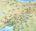
File:Arab-Byzantine frontier zone.svg

此 SVG 檔案的 PNG 預覽的大小:682 × 599 像素。 其他解析度:273 × 240 像素 | 546 × 480 像素 | 874 × 768 像素 | 1,166 × 1,024 像素 | 2,331 × 2,048 像素 | 1,705 × 1,498 像素。
原始檔案 (SVG 檔案,表面大小:1,705 × 1,498 像素,檔案大小:3.23 MB)
檔案歷史
點選日期/時間以檢視該時間的檔案版本。
| 日期/時間 | 縮圖 | 尺寸 | 使用者 | 備註 | |
|---|---|---|---|---|---|
| 目前 | 2019年2月18日 (一) 18:51 |  | 1,705 × 1,498(3.23 MB) | Cplakidas | again Tzamandos |
| 2019年2月18日 (一) 18:48 |  | 1,705 × 1,498(3.23 MB) | Cplakidas | fixing position of Tzamandos, some other minor tweaks | |
| 2012年6月15日 (五) 16:21 |  | 1,705 × 1,498(3.23 MB) | Cplakidas | minor tweaks & additions | |
| 2012年5月24日 (四) 18:09 |  | 1,705 × 1,498(3.14 MB) | Cplakidas |
檔案用途
下列2個頁面有用到此檔案:
全域檔案使用狀況
以下其他 wiki 使用了這個檔案:
- ar.wikipedia.org 的使用狀況
- azb.wikipedia.org 的使用狀況
- az.wikipedia.org 的使用狀況
- ba.wikipedia.org 的使用狀況
- bg.wikipedia.org 的使用狀況
- ca.wikipedia.org 的使用狀況
- cs.wikipedia.org 的使用狀況
- de.wikipedia.org 的使用狀況
- de.wikiversity.org 的使用狀況
- el.wikipedia.org 的使用狀況
- en.wikipedia.org 的使用狀況
- AD 707
- Abd al-Malik ibn Marwan
- Digenes Akritas
- Maslama ibn Abd al-Malik
- Arab–Byzantine wars
- Ashot I of Armenia
- Akritai
- Hadath
- Sayf al-Dawla
- Abu Firas al-Hamdani
- Melias
- Ali ibn Yahya al-Armani
- Battle of the Orontes
- User:Cplakidas/Articles
- Al-Awasim
- Siege of Tyana
- Siege of Kamacha
- Abbasid invasion of Asia Minor (806)
- User:Cplakidas/Sandbox/Byzantine-Arab3
- Battle of Marash (953)
- Battle of Raban
- Battle of Andrassos
- Eustathios Argyros (general under Leo VI)
- Tzamandos
- Rustam ibn Baradu
- Abu'l-Asha'ir Ahmad ibn Nasr
檢視此檔案的更多全域使用狀況。


