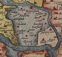
File:1580 Zelandicarum v Deventer.jpg

預覽大小:800 × 591 像素。 其他解析度:320 × 237 像素 | 640 × 473 像素 | 1,024 × 757 像素 | 1,280 × 946 像素 | 2,666 × 1,971 像素。
原始檔案 (2,666 × 1,971 像素,檔案大小:1.71 MB,MIME 類型:image/jpeg)
檔案歷史
點選日期/時間以檢視該時間的檔案版本。
| 日期/時間 | 縮圖 | 尺寸 | 使用者 | 備註 | |
|---|---|---|---|---|---|
| 目前 | 2007年12月2日 (日) 21:57 |  | 2,666 × 1,971(1.71 MB) | Joopr | {{Information |Description=title=Zelandicarum Insularum Exactissima Et Nova Descriptio, Auctore D. Iacobo A Daventria;size=34x47cm |Source=http://www.orteliusmaps.com/stocklists/12.html |Date=1580 |Author=Ortelius naar v Deventer |Permission= |other_versi |
檔案用途
下列4個頁面有用到此檔案:
全域檔案使用狀況
以下其他 wiki 使用了這個檔案:
- af.wikipedia.org 的使用狀況
- arz.wikipedia.org 的使用狀況
- bg.wikipedia.org 的使用狀況
- crh.wikipedia.org 的使用狀況
- cv.wikipedia.org 的使用狀況
- de.wikipedia.org 的使用狀況
- en.wikipedia.org 的使用狀況
- es.wikipedia.org 的使用狀況
- et.wikipedia.org 的使用狀況
- fr.wikipedia.org 的使用狀況
- fy.wikipedia.org 的使用狀況
- he.wikipedia.org 的使用狀況
- hu.wikipedia.org 的使用狀況
- id.wikipedia.org 的使用狀況
- it.wikipedia.org 的使用狀況
- ko.wikipedia.org 的使用狀況
- lbe.wikipedia.org 的使用狀況
- lb.wikipedia.org 的使用狀況
- mk.wikipedia.org 的使用狀況
- mwl.wikipedia.org 的使用狀況
- nl.wikipedia.org 的使用狀況
- no.wikipedia.org 的使用狀況
- os.wikipedia.org 的使用狀況
- pl.wikipedia.org 的使用狀況
- pt.wikipedia.org 的使用狀況
- ro.wikipedia.org 的使用狀況
- ru.wikipedia.org 的使用狀況
- ru.wikinews.org 的使用狀況
- sah.wikipedia.org 的使用狀況
- scn.wikipedia.org 的使用狀況
檢視此檔案的更多全域使用狀況。


