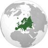
File:Europe orthographic Caucasus Urals boundary.svg

此SVG文件的PNG预览的大小:537 × 536像素。 其他分辨率:240 × 240像素 | 481 × 480像素 | 769 × 768像素 | 1,026 × 1,024像素 | 2,052 × 2,048像素。
原始文件 (SVG文件,尺寸为537 × 536像素,文件大小:77 KB)
文件历史
点击某个日期/时间查看对应时刻的文件。
| 日期/时间 | 缩略图 | 大小 | 用户 | 备注 | |
|---|---|---|---|---|---|
| 当前 | 2022年9月4日 (日) 13:32 |  | 537 × 536(77 KB) | M.Bitton | Reverted to version as of 12:03, 4 September 2022 (UTC): per COM:OVERWRITE |
| 2022年9月4日 (日) 13:30 |  | 537 × 536(177 KB) | Рагин1987 | Small correction | |
| 2022年9月4日 (日) 12:03 |  | 537 × 536(77 KB) | M.Bitton | Reverted to version as of 05:48, 12 March 2019 (UTC): per COM:OVERWRITE + fake svg | |
| 2022年8月30日 (二) 19:12 |  | 2,052 × 2,048(874 KB) | Рагин1987 | More correct visualization of the dividing line on the territory of the Caucasus Range | |
| 2019年3月12日 (二) 05:48 |  | 537 × 536(77 KB) | AndreyKva | Optimized. | |
| 2016年3月3日 (四) 19:25 |  | 537 × 536(197 KB) | Denniss | Reverted to version as of 13:27, 19 October 2014 (UTC) | |
| 2016年3月3日 (四) 18:37 |  | 537 × 536(239 KB) | Ercwlff | UC UC UC | |
| 2014年10月19日 (日) 13:27 |  | 537 × 536(197 KB) | Deni Mataev | Again, The entirety of Georgia is not in Europe geographically, only North Eastern parts are | |
| 2014年10月18日 (六) 20:05 |  | 537 × 536(238 KB) | Politologia | Reverted to version as of 10:57, 18 October 2014 In all maps Georgia is part of Georgia. There is at list 10 versions of borders of Europe in most of them Georgia is part of Europa | |
| 2014年10月18日 (六) 20:04 |  | 537 × 536(238 KB) | Politologia | Reverted to version as of 10:57, 18 October 2014 In all maps Georgia is part of Georgia. |
文件用途
超过100个页面使用本文件。 下面的列表只显示使用本文件的前100个页面。完整列表可用。
- 世界
- 世界政區索引
- 世界概况
- 亚欧非大陆
- 亚洲
- 亚特兰蒂斯
- 亞克羅提利與德凱利亞
- 亞塞拜然進行曲
- 亲爱的父母邦
- 今天在馬其頓之上
- 伦敦德里小调
- 何處是我家?
- 你古老,你自由
- 俄罗斯联邦武装力量
- 俄羅斯聯邦國歌
- 冈瓦纳大陆
- 剛果克拉通
- 劳亚大陆
- 勞倫大陸
- 北極大陸
- 北美洲
- 南美洲
- 南錐體
- 印度次大陸
- 哈薩克大陸
- 哥倫比亞大陸
- 啊,五月清亮的早晨
- 国歌 (立陶宛)
- 在年輕的萊茵河上
- 大洋洲
- 天佑國王
- 姆大陆
- 威廉颂
- 宗座瑞士近衛隊
- 对!我们热爱祖国
- 山的土地,河的土地
- 布拉班特人之歌
- 希臘武裝部隊
- 德意志之歌
- 意大利人之歌
- 我们的国家
- 我們的祖國 (亞美尼亞)
- 我的哈萨克斯坦
- 我的土地,我的欢愉
- 戰士之歌
- 扬子克拉通
- 挪威國防軍
- 收割者
- 教宗进行曲
- 有一處好地方
- 未知的南方大陸
- 格鲁吉亚武装部队
- 次大陆
- 欧洲
- 歐洲LGBT權益
- 歐洲之歌
- 歐美大陸
- 正義的上帝
- 比利時國防軍
- 法國武裝部隊
- 波兰没有灭亡
- 波斯尼亚和黑塞哥维那国歌
- 波羅的大陸
- 洲
- 潘諾西亞大陸
- 烏克蘭仍在人間
- 烏爾大陸
- 父辈的土地
- 独立自由的阿尔察赫
- 独立进行曲
- 瑞典國防軍
- 瑞士诗篇
- 瑞士軍事
- 白令陸橋
- 白俄罗斯共和国国歌
- 皇家進行曲
- 盤古大陸
- 科索沃共和國國歌
- 終極盤古大陸
- 羅迪尼亞大陸
- 美洲
- 義大利武裝部隊
- 聯邦國防軍
- 自由 (格魯吉亞國歌)
- 自由颂
- 芬蘭國防軍
- 英國武裝部隊
- 華北陸塊
- 葡萄牙人 (國歌)
- 西伯利亞大陸
- 西班牙军队
- 讚美歌 (匈牙利)
- 许珀耳玻瑞亚
- 赞美歌 (冰岛)
- 超大陸
- 辛梅利亞大陸
- 醒来吧,罗马尼亚人
- 阿尔巴尼亚武装部队
- 阿瓦隆尼亞大陸
- 非洲
查看连接到这个文件的更多链接。
全域文件用途
以下其他wiki使用此文件:
- ab.wikipedia.org上的用途
- ace.wikipedia.org上的用途
- ady.wikipedia.org上的用途
- af.wikipedia.org上的用途
- ar.wikipedia.org上的用途
- بوابة:آسيا
- بوابة:أوروبا
- بوابة:إفريقيا
- بوابة:القارة القطبية الجنوبية
- بوابة:القارة القطبية الجنوبية/بوابات شقيقة
- قائمة جوازات السفر
- بوابة:تركيا
- بوابة:تركيا/بوابات شقيقة
- بوابة:جغرافيا/مقالة مختارة/أرشيف
- المرأة في تركيا
- بوابة:أوروبا/واجهة
- بوابة:تصفح
- بوابة:تصفح/جغرافيا
- قائمة مفاتيح الاتصال الدولية
- المرأة في ألمانيا
- بوابة:إسطنبول
- بوابة:آسيا/بوابات شقيقة
- ويكيبيديا:مقالة الصفحة الرئيسية المختارة/398
- بوابة:جغرافيا/مقالة مختارة/21
- معاملة المثليين في أوروبا
- المرأة في أوروبا
- المرأة في البرتغال
- المرأة في فنلندا
- المرأة في مقدونيا الشمالية
- المرأة في ترانسنيستريا
- المرأة في الفاتيكان
- المرأة في أذربيجان
- المرأة في اليونان
- المرأة في ألبانيا
- المرأة في إيطاليا
- المرأة في الجبل الأسود
查看此文件的更多全域用途。


