File:British bechuanaland 1887.jpg

本预览的尺寸:606 × 600像素。 其他分辨率:243 × 240像素 | 485 × 480像素 | 776 × 768像素 | 1,035 × 1,024像素 | 1,644 × 1,627像素。
原始文件 (1,644 × 1,627像素,文件大小:181 KB,MIME类型:image/jpeg)
摘要
| 描述 |
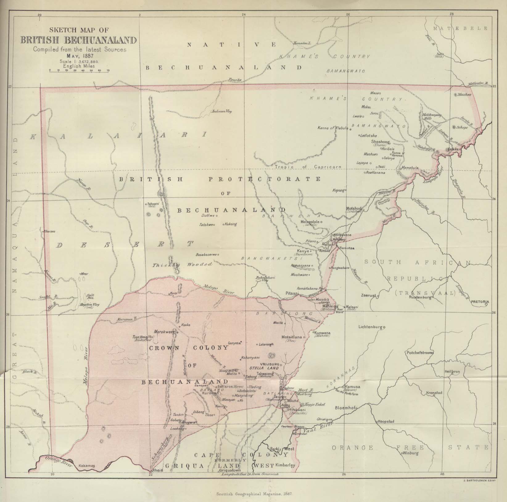
Deutsch: Karte von Betschuanaland, Mai 1887.
English: Sketch Map of British Bechuanaland, May 1887. |
| 日期 | |
| 来源 |
The Scottish Geographical Magazine. Published by the Scottish Geographical Society and edited by Arthur Silva White. Volume III, 1887. |
| 作者 | John George Bartholomew |
许可协议
|
本作品在其来源国以及其他著作权期限是作者逝世后70年或以下的国家和地区属于公有领域。 | |
| 本文件已被确认为免除已知的著作权法限制(包括所有相关权利)。 | |
文件历史
点击某个日期/时间查看对应时刻的文件。
| 日期/时间 | 缩略图 | 大小 | 用户 | 备注 | |
|---|---|---|---|---|---|
| 当前 | 2005年8月24日 (三) 21:09 | | 1,644 × 1,627(181 KB) | Atamari | British bechuanaland (1887) {{PD-old}} * source from http://www.lib.utexas.edu/maps/historical/british_bechuanaland_1887.jpg * "Sketch Map of British Bechuanaland, May 1887" from the Scottish Geographical Magazine. Published by the Scottish Geographical |
文件用途
全域文件用途
以下其他wiki使用此文件:
- af.wikipedia.org上的用途
- ast.wikipedia.org上的用途
- ca.wikipedia.org上的用途
- da.wikipedia.org上的用途
- de.wikipedia.org上的用途
- en.wikipedia.org上的用途
- eo.wikipedia.org上的用途
- es.wikipedia.org上的用途
- et.wikipedia.org上的用途
- fr.wikipedia.org上的用途
- id.wikipedia.org上的用途
- it.wikipedia.org上的用途
- ja.wikipedia.org上的用途
- no.wikipedia.org上的用途
- pl.wikipedia.org上的用途
- pt.wikipedia.org上的用途
- pt.wikibooks.org上的用途
- ru.wikipedia.org上的用途
- sv.wikipedia.org上的用途
- uk.wikipedia.org上的用途
- www.wikidata.org上的用途
- wuu.wikipedia.org上的用途